
Chloé Laplantine
UMR 7597 – Laboratoire Histoire des Théories Linguistiques, Université Paris Diderot
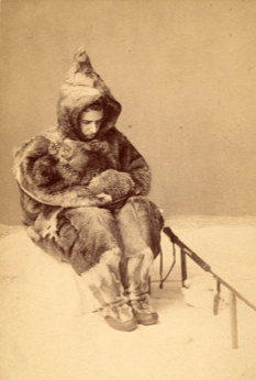
F. Boas posant en train de représenter un chasseur de phoque inuit (Minden, Allemagne, 1885)
As we require a new point of view now, so future times will require new points of view and for these the texts, and ample texts, must be made available.[1]
Comme nous avons besoin d’un nouveau point de vue maintenant, et de la même manière les temps futurs auront besoin de nouveaux points de vue et pour ceux-là les textes, et beaucoup de textes, doivent être rendus accessibles.
En dehors de l’ouvrage Primitive art (traduit en 2003), l’œuvre de Franz Boas n’a jusqu’à maintenant pas été traduite en français[2]. La réception du travail de Boas en France est très mince et réservée certainement aux étudiants en ethnologie (ce qui participe aussi à la réduction de l’envergure de cette œuvre). Dans son article « Histoire et ethnologie » (1949), qui deviendra l’introduction de Anthropologie structurale, Claude Lévi Strauss avait donné à lire en traduction différents passages de textes de Boas. Mais en dehors de cet important écho, et de cet effort de passage en français, Boas reste en France un inconnu lu en anglais et par bribes. Pour ce qui est de sa réflexion linguistique, il est celui qui parle de la neige, et des phoques.
F. Boas a ré-organisé l’étude des langues amérindiennes (à la suite du Major J.W. Powell), en établissant une méthode neuve d’analyse, et l’« Introduction » du Handbook (texte de 83 pages) est le texte-manifeste de ce projet, dans lequel il enrôle ses disciples et collègues. L’une des nouveautés du projet linguistique de Boas est l’abandon du modèle de la grammaire latine, pour une grammaire analytique écrite depuis le point de vue amérindien : the grammar has been treated as though an intelligent Indian was going to develop the forms of his own thoughts by analysis of his own form of speech. (p.81[3]) – « la grammaire a été traitée comme si un Indien intelligent se mettait à développer les formes de ses propres pensées par une analyse de sa propre forme de discours ».
Le travail de traduction rend inévitablement sensible à la manière d’écrire d’un auteur. Chez Franz Boas, cette manière d’écrire n’est pas séparable de la manière d’aborder les problèmes. En lisant et traduisant l’« Introduction » du Handbook of American Indian Languages (travail en collaboration avec Andrew Eastman), on remarque que la théorie du point de vue que Franz Boas développe, et qui constitue un argument majeur contre les théories racistes ou banalement ethnocentriques de son époque, n’est pas séparable d’une écriture du point de vue.
L’anglais n’est pas la langue native de Boas ; son anglais n’est ni idiomatique ni esthétique (à tel point que la traduction peut être difficile car on traduit un anglais un peu limité), néanmoins, aussi limité qu’il soit, répétitif, aussi lourd parfois, on doit reconnaître que la manière d’écrire de Boas est la mise en œuvre et l’enseignement d’une méthodologie du travail en sciences humaines et qu’on aurait du mal à vouloir qu’elle soit différente. Read more ›


